Why Some City Streets Meet at Angles
Why city streets meet at angles: learn to read terrain, older routes and planning choices in the shape of a junction, and see what its lines reveal.
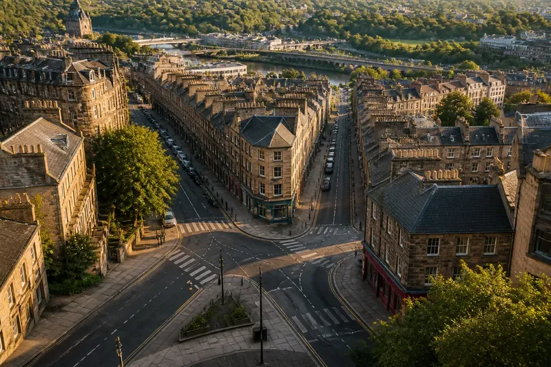
The common mistake is to treat an angled street junction as a crooked version of a grid. That can make you miss the clue it offers: a diagonal may preserve an older route, follow a slope, or mark a deliberate planning decision. To understand why city streets meet at angles, look at what each street is doing before deciding the junction is irregular.
Why do city streets meet at angles?
Streets meet at angles when their routes were laid out for different purposes or at different times. One may follow a property boundary while another follows a ridge, stream crossing, or established path. Later streets often connect to what is already there rather than erase it, leaving a junction where the alignments do not match.
The angle itself is not a complete explanation. A sharp meeting can result from two straight streets arriving on separate lines, while a street that bends gradually may have followed a natural contour or adjusted around obstacles. Read the lines beyond the intersection: their continuation, their edges, and the buildings beside them usually provide more information than the junction alone.
Can terrain explain a diagonal street?
Yes. Slopes, ridges, valleys, and waterways can steer streets away from a simple right-angle pattern. A road may follow a gentler grade along a hillside, run along a ridge, or angle toward a practical crossing point. On a map, a diagonal that parallels contour lines may be following the land rather than cutting across it.
Water can leave a similar trace even after it has been covered or diverted. A street may track the line of a former stream, while another approaches at an angle because a crossing was easiest at one particular point. Look for supporting signs nearby, such as a valley-like dip, a bridge, a path beside a channel, or a sequence of streets that share the same bend.
Terrain is a plausible explanation, not a verdict. A street can be angled for reasons unrelated to the slope, and modern grading can disguise the original ground. Compare a street map with a topographic map, if one is available, and treat a pattern across several blocks as stronger evidence than one intersection.
Do angled junctions preserve older routes?
Often, they can. A path or road may predate the surrounding blocks and remain in use as the city expands. New streets then meet that route at whatever angles fit the land and property lines. The older line can survive as a diagonal street even when the blocks around it form a more regular pattern.
To look for this pattern, trace the diagonal beyond the junction in both directions. Does it continue through several blocks? Does it connect a bridge, market area, station, old gate, or another established destination? A long, continuous line that links useful places may be an inherited route rather than a short-lived design flourish.
Parcel boundaries can offer another clue. On a cadastral or parcel map, narrow lots or property edges may align with the diagonal even where nearby blocks do not. That suggests the route and its adjoining land may have been organized together, though the map alone will not establish which came first.
What planning choices create angled streets?
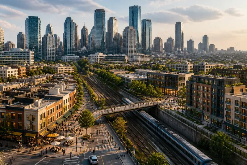
Planners may introduce diagonal streets to connect distant points, meet a boundary, frame a public building, or fit a new district around an existing road. A diagonal avenue can cut across a regular street pattern, while a short angled connector can reconcile two layouts that were drawn from different starting lines.
Property ownership also shapes street geometry. If a new street has to pass between established parcels, its route may turn or meet another street obliquely to avoid dividing land in an impractical way. At a district edge, an angled junction may reveal where one plan stopped and another began, especially if the street alignments change abruptly across the boundary.
Imagine a new neighborhood planned beside an older road that runs toward a river crossing. The designers keep that road as the main connection and lay out side streets on a new alignment. The visible result would be side streets meeting the older road at different angles, with the diagonal continuing toward the crossing.
What clues can you read at the junction?
Start with the street lines, then check whether the surrounding block shapes support the same explanation. An angled junction can produce a wedge-shaped parcel, a clipped corner, or a small triangular space. Those forms may show how builders adapted to the crossing lines, but a triangle by itself does not prove why the streets were drawn that way.
- Trace both approaches: note whether each street continues straight, bends, or ends just beyond the junction.
- Compare nearby blocks: see whether the angle interrupts a regular pattern or repeats across a wider area.
- Check the ground: look for a slope, ridge, valley, watercourse, or crossing that could influence the route.
- Follow destinations: see whether the diagonal links identifiable civic, transport, or commercial places.
- Inspect parcel lines: compare lot edges with the street direction for signs of an older boundary or alignment.
- Notice the street edge: observe whether building fronts follow the diagonal or retain a different line, which may reveal how the space was fitted together.
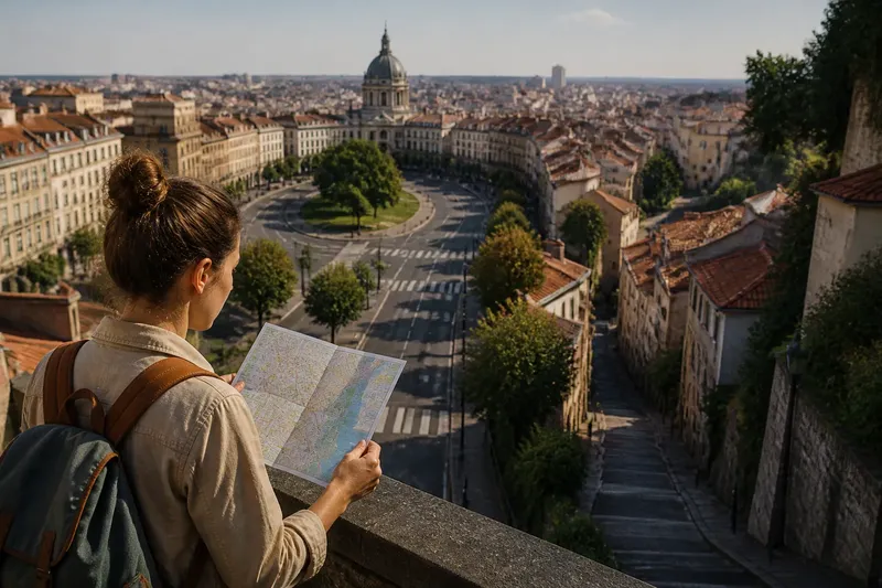
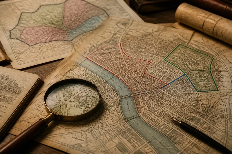
Use the clues together rather than treating any single feature as decisive. A phone map can show street continuity; a topographic map can help with terrain; and a parcel map can reveal property geometry. Older maps, where available, can show whether the diagonal existed before nearby streets took their current form.
Why do some angled junctions feel awkward?
They can create long crossings, narrow corners, or an unclear path through the intersection. A person walking may have to look in several directions, and a driver may approach with limited sightlines. The effect depends on the junction’s design and use, not simply on the angle between the streets.
Street furniture and building placement can make the geometry easier or harder to read. A curb extension may shorten a crossing, while parked vehicles or a blank wall can obscure approaching traffic. On foot, notice where the sidewalks continue, whether crosswalks lead naturally to one another, and whether the building edges help define the space.
Which questions help identify a street’s origin?
Does a diagonal street always follow an old road?
No. It might reflect terrain, a property line, or a planned connection instead. Look for continuity and links to likely destinations, then compare the route with maps of the land and surrounding parcels.
Can a street angle show where two plans meet?
It can suggest a boundary between layouts, especially when the street pattern changes sharply across the junction. Check whether the shift continues along a district edge or appears only at one intersection.
Why do angled junctions often have triangular lots?
When streets meet on different alignments, the leftover space between their edges may form a triangle. The lot’s boundaries and building orientation can show how property owners or planners adapted to that shape.
What map is most useful for reading an angled junction?
Use the map that answers your question: a topographic map for slopes, a parcel map for property lines, or older street maps for changes over time. The best reading comes from comparing map evidence with what the street and its surroundings look like today.
How can you read an angled junction on a walk?
Pause where the street lines separate and pick one alignment to follow. Look down each approach, then turn around and trace the route in the opposite direction. This simple habit is like comparing the grain of two pieces of wood: the meeting point makes more sense when you can see the direction each line came from.
Record what is observable rather than guessing at a single cause. Note the slope, block shapes, nearby destinations, property edges, and any change in street pattern. If the clues point in different directions, keep more than one explanation open until a map or a longer walk helps sort them out.
When you ask why city streets meet at angles, the most useful answer is often a combination of causes: land that favored one route, a path that already mattered, and later plans fitted around both. Follow the alignment beyond the corner, and the junction becomes a record of how separate decisions were joined into one city.